• Focused on the Future, Built on Tradition,
    Committed to Excellence... Since 1901

  • Focused on the Future, Built on Tradition,
    Committed to Excellence... Since 1901

Duke University Central Campus Revitalization

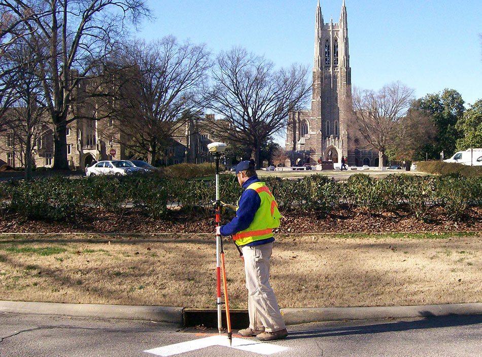
Taylor Wiseman & Taylor performed base mapping and utility locating that would be necessary for design engineers and architects to utilize in the planning and development of a revitalized central campus. This project would realign existing streets, demolish and rebuild student housing, create parking decks and improve the utility infrastructure.

The scope of work for this project included the following:

  • Property research, boundary surveying & mapping of 42 parcels of land (over 100 property corners and over 7 miles of property lines)
  • Establishment of survey control points throughout the project area that were tied to the NC State Plane Coordinate System
  • The combination of photogrammetric and conventional surveying methods to produce a base map of all visible planimetric and topographic features (TWT subcontracted with Carolina Resource Mapping for the photogrammetry work)
  • All trees over 6″ dba (6,712 total) surveyed & mapped
  • Quality Level “B” subsurface utility designating for over 30 miles of underground electric, steam, water, phone, fiber optic, gas, chilled water and irrigation lines
  • Wetlands mapping
  • Field inspection of all sanitary and storm sewer lines to determine vertical positions of the lines (over 500 sanitary sewer manholes and storm structures were mapped)
  • Submittal of AutoCAD drawings and digital orthophotos

TWT completed this initial phase to the University’s satisfaction and was asked to perform the second phase of the project with no competition. TWT was also contracted by Duke to convert the Phase 2 AutoCAD data into ESRI format for insertion into the University’s GIS database.

© Taylor Wiseman & Taylor | Website by Burlington Press